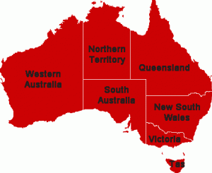
 Western Australia (abbreviated as WA) is a state of Australia, occupying the entire western third of the Australian continent. It is bounded by the Indian Ocean to the north and west, the Great Australian Bight and Indian Ocean to the south, the Northern Territory to the north-east and South Australia to the south-east.
Western Australia is Australia’s largest state and the second largest subnational entity in the world. It has 2.3 million inhabitants (10% of the national total), 85% of whom live in the south-west corner of the state.
The first European to visit Western Australia was the Dutch explorer Dirk Hartog, who visited the Western Australian coast in 1616. The British established a military outpost at King George Sound, near present-day Albany, in 1826, which was followed by the establishment of the Swan River Colony in 1829, including the town site of the present-day capital, Perth.
Western Australia achieved self-government in 1890, and later federated with the other British colonies in Australia in 1901. Today Western Australia’s economy mainly relies on mining, agriculture and tourism. WA supplies 36% of Australia’s overseas exports and is the third largest iron-ore producer in the world.
Western Australia is bounded by South Australia and the Northern Territory to the east, and the Indian Ocean to the west and north. The International Hydrographic Organization (IHO) designates the body of water south of the continent as part of the Indian Ocean, although it is officially gazetted as the Southern Ocean in Australia.
The total distance of the state’s eastern borders is 1,862 km (1,157 mi),[7] and there is 12,889 km (8,009 mi) of coastline. The total land area occupied by the state is 2.5 million km2.
Content from this page is drawn from Here.

